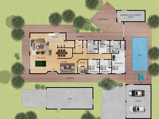
10 Processing Steps
1. Collect property dimensions and plot map
2. Identify building location on the site
3. Draw property boundary lines and structures
4. Add driveways, walkways, and entry points
5. Include landscape elements (trees, gardens, lawns)
6. Show outdoor features (pools, decks, patios, fences)
7. Mark utilities and service areas (HVAC, meters)
8. Add labels for buildings, roads, and features
9. Apply color, textures, or shading (optional)
10. Final review and export in required format (PDF, PNG, etc.)
Collection